As drone technology advances, new possibilities emerge in remote sensing and mapping. Two of the most popular techniques are drone LiDAR and drone photogrammetry. Both methods have their own unique advantages and disadvantages, making it crucial for businesses and professionals to understand the differences to choose the right approach for their projects. In this blog post, we'll dive deeper into the core technologies, precision, efficiency, data processing, and ideal applications for each method.
Core Technologies
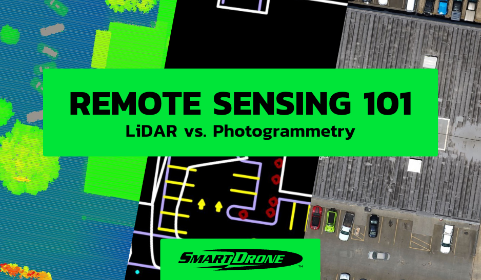
Drone LiDAR (Light Detection and Ranging) is a remote sensing technique that uses laser pulses to measure distances and generate detailed 3D maps. The drone-mounted LiDAR sensor emits thousands of laser pulses per second, which bounce off objects and return to the sensor. By calculating the time it takes for each pulse to return, the system can determine the distance and create a point cloud representation of the environment.
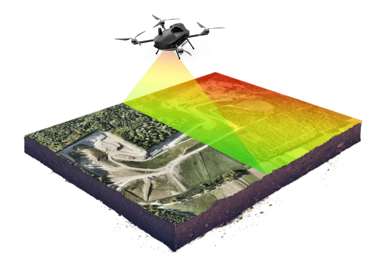
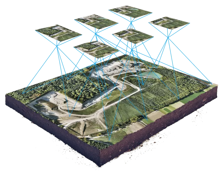
On the other hand, drone photogrammetry involves capturing high-resolution images from various angles using a drone-mounted camera. These images are then processed using specialized software, such as Pix4Dmapper, which employs advanced algorithms to identify common points and stitch the images together, ultimately creating a 3D model of the area.
Precision & Accuracy
Both drone LiDAR and photogrammetry can produce highly accurate results. However, LiDAR typically offers greater precision and accuracy, especially in areas with dense vegetation or complex terrain. This is because LiDAR can penetrate vegetation and directly measure the ground surface wherever light from a laser can penetrate, whereas photogrammetry relies on visible surfaces in images, which can be obstructed by foliage.
Moreover, LiDAR is less affected by external factors like lighting conditions, and shadows, but struggles with highly reflective surfaces. Photogrammetry, being image-based, may encounter challenges in areas with low light or high contrast, affecting the quality of the 3D model.
DEBUNKED: The Top 3 Myths About Drones and Land Surveying
Time & Cost Efficiency
When comparing the efficiency of drone LiDAR and photogrammetry, several factors come into play. For smaller projects, photogrammetry can be faster and more cost-effective, as it requires less specialized equipment and the processing time can be shorter. However, as the project area increases, LiDAR may become more efficient due to its ability to capture high-resolution data rapidly, no matter how vegetated the terrain is.
LiDAR's capacity to penetrate vegetation also makes it the preferred choice for mapping forests or heavily wooded areas. This capability can save both time and resources, as manual clearance of vegetation or multiple flights to capture ground-level imagery are not required.
In some cases, you might need a drone that can capture both LiDAR and photogrammetric data simultaneously, like the Discovery 2.
Data Processing
The data output from drone LiDAR and photogrammetry differ significantly. LiDAR generates a point cloud, which is a collection of 3D coordinates representing the scanned environment. This point cloud data must be processed using specialized software to create more useful data, like 1-foot contours, or perform further analysis.
Photogrammetry generates detailed, textured 3D models that can be directly used for visualization and analysis. The resulting models are visually appealing and can be easily shared with clients or stakeholders. However, the image-based nature of photogrammetry may limit its usefulness in specific applications where precise measurements and analysis are required.
Ideal Applications
Drone LiDAR is ideal for projects that require high precision and accuracy, such as topographic mapping, forestry, infrastructure inspection, and environmental monitoring. Its ability to penetrate vegetation and provide accurate ground measurements makes it invaluable in these industries.
Drone photogrammetry is better suited for projects focused on visual appeal and where high-resolution images are essential. Real estate marketing, urban planning, and cultural heritage documentation are some of the fields where photogrammetry excels. It can also be an excellent choice for construction site monitoring, where regular updates on project progress are needed.
SUCCESS STORY: How Our Drone Mapping Services Helped A Surveyor Overcome Challenges
Conclusion
In conclusion, both drone LiDAR and drone photogrammetry have unique strengths and applications in the realm of remote sensing and mapping. While LiDAR offers superior precision and accuracy, making it ideal for projects demanding high-quality data, photogrammetry shines in visually-oriented applications and smaller-scale projects. Understanding the differences between these two methods is crucial for professionals and businesses looking to make informed decisions. By considering factors such as project requirements, budget, and desired output, you can choose the most appropriate technique to ensure the success of your project and maximize the benefits of drone technology.
SmartDrone offers drone LiDAR and photogrammetric services nationwide. Get accurate, fast, cost-effective data collection for subdivision planning, 1-foot contours, and more. Get in touch today to learn more about our aerial drone services.