In the rapidly evolving world of remote sensing and mapping technologies, orthomosaics generated from drone photogrammetry have become invaluable assets in various industries. This blog aims to shed light on what orthomosaics are, how they are created using drone photogrammetry, and why they're essential in today's drone mapping services.
What Are Orthomosaics?
Orthomosaics are highly detailed, accurate, and geometrically corrected aerial images created by stitching together multiple overlapping drone-captured photos. Unlike standard aerial photographs, orthomosaics eliminate distortions like terrain relief and camera tilt, offering a true-to-scale representation of the surface. They serve as a reliable base map for GIS applications in sectors like agriculture, construction, and environmental monitoring.
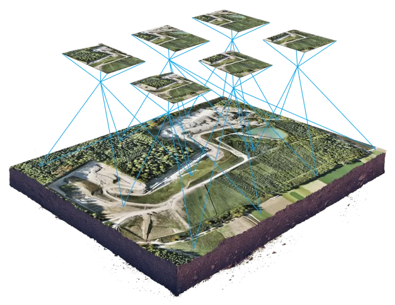
A visual representation of an orthomosaic and the images used to generate it.
What is Drone Photogrammetry?
Drone photogrammetry is a technique that involves using drones equipped with high-resolution cameras to capture aerial images of a particular area. These images are then processed and analyzed to create 3D models, maps, and, yes, orthomosaics. Compared to other technologies like drone LiDAR, drone photogrammetry is generally more cost-effective and is excellent for projects that require high-resolution, textured images.
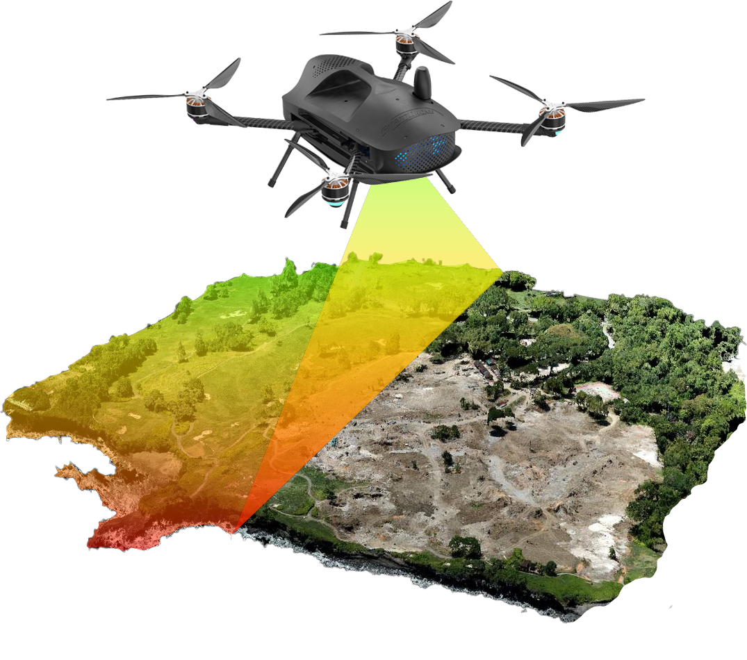
A visual representation of the Discovery 2 drone capturing photogrammetric data.
The Process of Creating Orthomosaics
Planning the Mission
Before launching your drone, it's crucial to plan your flight path meticulously. You'll need to determine the altitude, overlap rate, and flight speed, among other variables. Accurate planning ensures the quality of the final orthomosaic.
Capturing the Imagery
Once your mission plan is set, you can proceed to capture images using drone services that specialize in photogrammetry. Make sure to use drones equipped with high-resolution cameras and GPS for the best results.
Make the right choice: How to Choose the Right Drone for Surveying
Image Processing
After capturing the necessary images, you can now use specialized photogrammetry software like Pix4D or Agisoft Metashape to create orthomosaics. The software stitches together the overlapping photos while correcting distortions and generating a georeferenced orthomosaic.
Orthorectification
Orthorectification is the process of removing distortions and errors from aerial images to ensure they are geometrically accurate and true to scale. These distortions can result from various factors like the curvature of the Earth, camera tilt, and changes in topography. By using ground control points and specialized algorithms, orthorectification corrects these issues, allowing the images to be used in a geospatial context accurately.
.gif?width=256&height=256&name=Lidar%20Basics%20-%20Final(HQ).gif) An orthomosaic overlaid on a LiDAR point cloud provides context to the land.
An orthomosaic overlaid on a LiDAR point cloud provides context to the land.
Benefits of Orthomosaics in Drone Mapping Services
- Spatial Accuracy: One of the main benefits of orthomosaics is the high level of spatial accuracy it brings to the data. When mapping or surveying an area, it's crucial that the data you're using is as accurate as possible. Orthorectified images allow for accurate measurements of distance, area, and other geographic parameters.
- Context: Orthomosaics provide true-to-life, high-resolution images of the ground. This helps in interpreting the LiDAR data, especially in distinguishing between features that may have similar LiDAR returns but different visual characteristics.
- Consistency: Multiple datasets captured at different times can be easily integrated and compared. This is invaluable in monitoring and assessing changes in land use, environmental conditions, and construction progress over time.
- Improved Analysis: The geometric accuracy provided by orthomosaics allows for more precise data analysis. Whether you're assessing crop health, planning a construction project, or analyzing environmental data, the accuracy of orthorectified images significantly enhances the reliability of your findings.
- Interoperability: Orthomosaics can be easily integrated into Geographic Information Systems (GIS), aligning perfectly with other geospatial data, such as LiDAR. This makes them incredibly versatile and widely applicable in professional drone mapping services.
- Versatility: Orthomosaics are useful in a range of applications, including agriculture for crop monitoring, construction for site planning, and environmental projects for habitat assessment.
SUCCESS STORY: How Our Drone Mapping Services Helped A Surveyor Overcome Challenges
Conclusion
Creating orthomosaics through drone photogrammetry has revolutionized the way we approach mapping and surveying tasks. It offers a cost-effective, accurate, and efficient method of capturing high-resolution imagery that can be utilized in various industries. Whether you opt for drone LiDAR or photogrammetry largely depends on your specific project needs, but when it comes to generating detailed and accurate 2D maps, orthomosaics hold a significant edge.
Looking for professional drone mapping services? Reach out to us for a comprehensive range of drone services, including high-quality orthomosaics and 3D mapping. We are here to elevate your projects to new heights.