A potential client calls and is scheduling construction on a 320 Acre property consisting of overgrown timber forest - the deliverable is a 1-foot contour map of the entire property. The client wants to properly dam three waterways coming into the property and cut timber to make a lake for bass fishing and recreation. As a hunting enthusiast he is looking to find high vantage points on the property, and clear shooting lanes. Then, as expected, he asks how much it would cost to get this done yesterday.
Bonus Behind the Scenes:
Prior to Rob's trip to scan the job in one day, our team went in the field to validate the first three production units coming off our assembly line - we captured this video that day. You will see first hand the terrain at this job site.
As an experienced surveyor, what would your first thoughts be? Would it be about the lanes you are going to have to cut to get accurate break lines? Have you considered using a drone for mapping or using an aerial drone survey? Or would you immediately think about how you could fit this in your busy schedule?
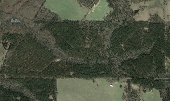
Two public aerial views of the job site.
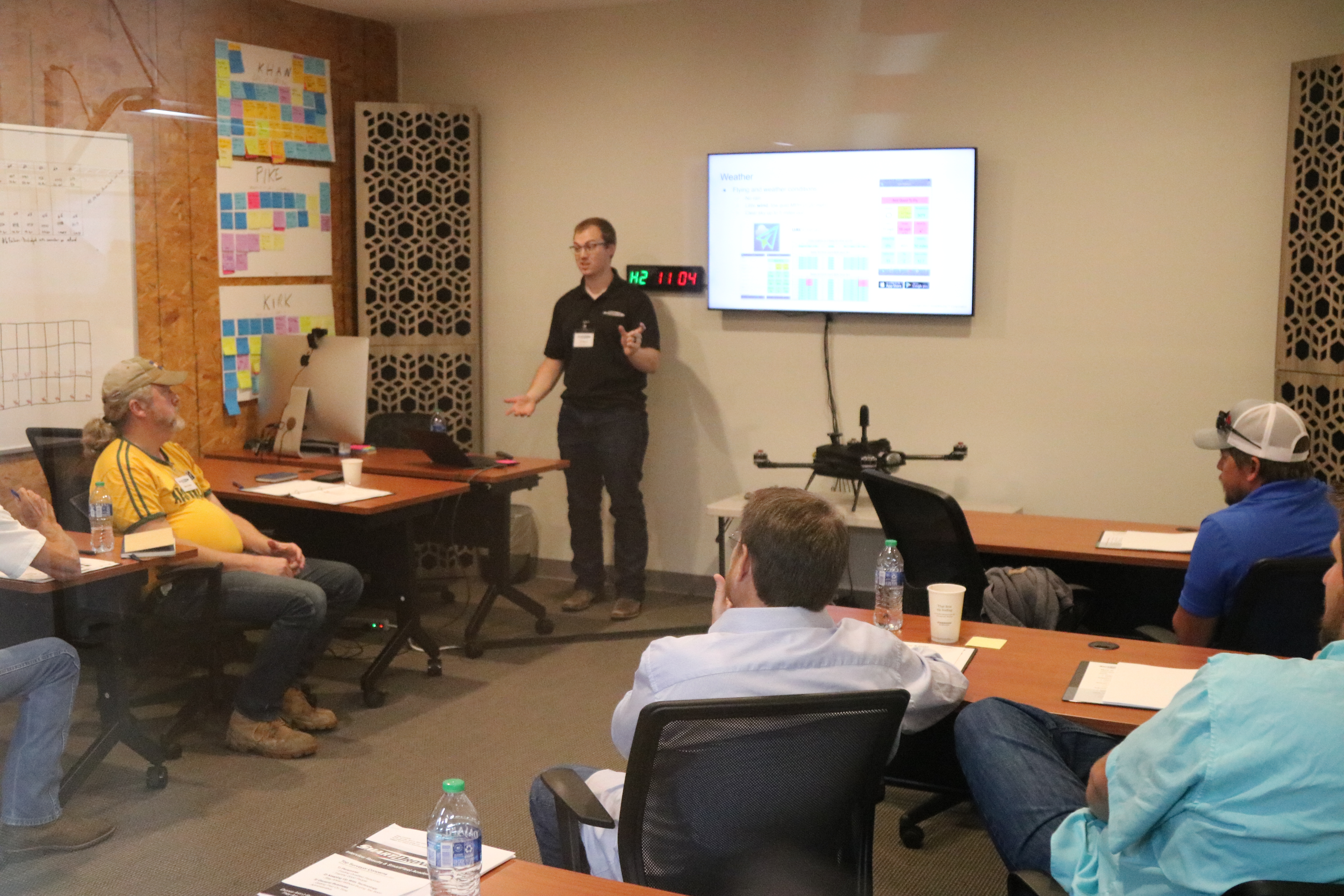
At SmartFleet Academy events, we present the same information and ask surveyors or civil engineers to guess what this job would cost the customer using traditional methods.
This is the exact job type that is a breeze for the SmartDrone Discovery. Rob Cammack, our CEO, set out on a Saturday with a Discovery unit in the back of his UTV and planned seven 50-acre missions with 3 different launch points. Over the course of 5 hours, he autonomously flew those 7 flights over the 320-acre property, processed the data in the field, and then packed up and headed home.
That afternoon, in just 2 hours using SmartDrone’s one-click processing drone software, Rob had results that allowed him to begin planning what the lake would look like. The next day, he was able to apply CORS Virtual Base Station corrections to the data to create a dataset that was validated to meet NMAS 1ft contour standards.
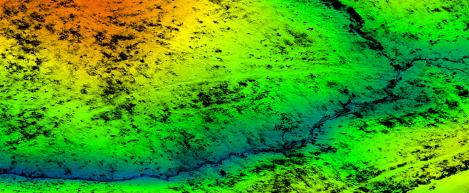 Two aerial views from Discovery, available in the field, showing the 320 Acres collected in one day with one operator.
He was also able to import the data into a variety of CAD software (Carlson, Civil3D, TBC, microstation, etc.) to have a surveyor identify break lines and generate contours for quick turnaround and property development planning.
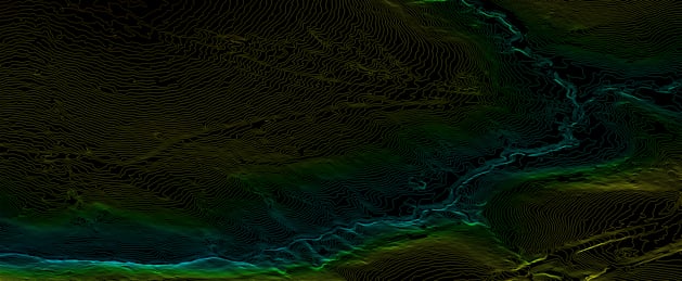 Contour lines - generated in Cloud Compare point cloud software - implementing 24 hour CORS corrections as a virtual base station.
There are several UAV scanner lidar applications available to the professional surveyor. LIDAR offers unique advantages over photogrammetry in many jobs like this one. LIDAR can see the ground through most tree canopies. This allows contour mapping in scenes where photogrammetry would be unable to view the ground below.
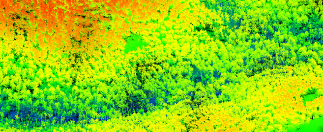
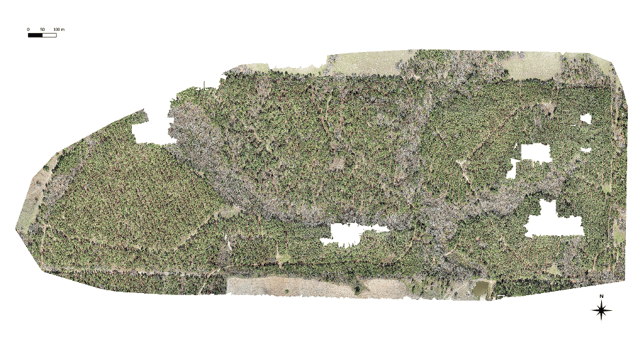 Photogrammetry results collected when our team visited the job site prior to Rob's one day scan.
The white voids in the scene come from the inability of the orthomosaic algorithm to patch adjacent pictures together because of the dense and amorphous tree cover. As a corollary, the contour map that would be generated using the photogrammetry would have large voids or unreliable data. In contrast the LIDAR produced reliable contour information across the entire scene increasing the quantity of suitable jobs with drones.
More content is available in the full case study.