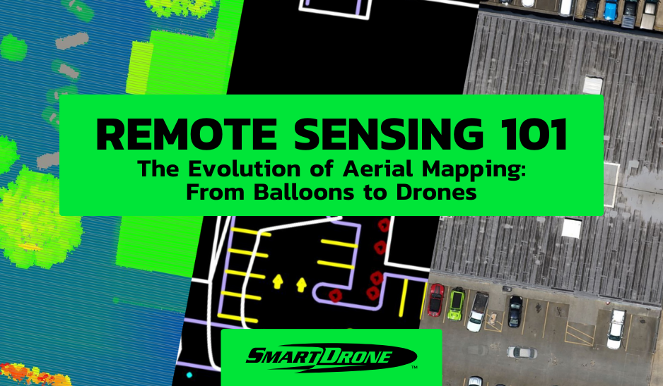
Aerial mapping has been an ever-evolving endeavor since the time humans realized the value of a bird's-eye view. This journey began far before the advent of modern technology, tracing back to the days of hot air balloons, moving on to airplanes, satellites, and now, drones. In this blog post, we delve into this fascinating evolution, examining how each stage has shaped our understanding of the Earth's topography and how drones have become the latest, invaluable tool in this historical lineage.
.jpg?width=264&height=420&name=Felix_Nadar_in_a_balloon%2c_late_1860s_photographer_Felix_Nadar_(4559203377).jpg)
Nadar c. 1863, studio portrait, carte-de-visite
The Balloon Era: Pioneered by Nadar
The earliest attempts at aerial mapping took to the skies in the form of hot air balloons. French photographer Gaspard-Félix Tournachon, commonly known as Nadar, pioneered the technique back in the 1850s. Although crude by today's standards, the concept of capturing landscapes from an elevated viewpoint was groundbreaking. However, balloons had their limitations: they were at the mercy of wind currents, and the quality and scale of mapping were quite restricted.
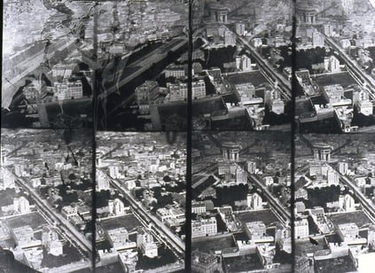
Nadar c. 1868, aerial view of Paris
The Age of Airplanes
With the invention of the airplane, aerial mapping took a significant leap forward. Aircraft allowed for more controlled and expansive surveying. Photographs taken from planes provided better resolution and coverage than ever before. During the 20th century, airplanes became the standard for large-scale mapping projects, from government surveys to scientific research. Despite the advancements, airplane-based aerial mapping was costly, time-consuming, and still lacked the flexibility needed for more complex or smaller-scale projects.
.jpg?width=423&height=237&name=Explorer_Abrams_PC-4_Explorer_(16140188595).jpg)
The Abrams P-1 Explorer, 1937, was one of the first planes built for aerial photography
The Satellite Revolution
The space age introduced another milestone in the form of satellite-based mapping. Since the launching of the first artificial satellite, Sputnik, in 1957, the ability to capture data took on a global scale. Satellites could provide imagery and data of vast areas, sometimes covering entire countries in a single pass. However, satellites had limitations—such as high operational costs, susceptibility to atmospheric conditions, and inflexible timing—that necessitated another evolutionary step.
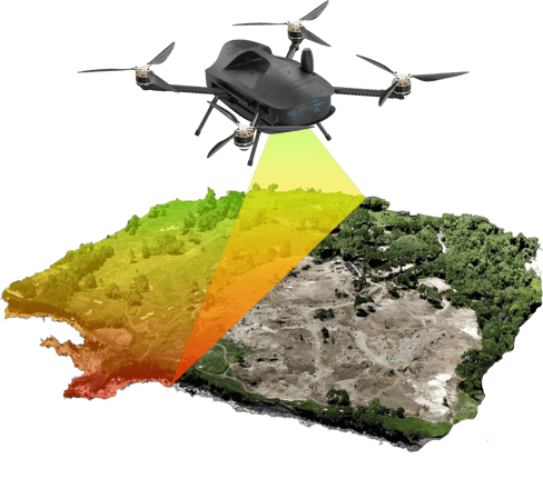
A visual depiction of the Discovery 2 drone mapping an area of land
Drones: A New Dawn in Aerial Mapping
Enter drones, or Unmanned Aerial Vehicles (UAVs), which have rapidly become a transformative force in the aerial mapping arena. Drones offer an unprecedented level of flexibility, cost-effectiveness, and precision in data collection.
Flexibility
Drones can be deployed quickly and tailored to specific project needs, capturing targeted data in real-time, a significant advantage over older methods.
Cost-effectiveness
While initial investments can be high, drones offer long-term cost benefits by eliminating the need for third-party services, whether they be airplane or satellite-based.
Precision
Flying at lower altitudes compared to their predecessors, drones can capture incredibly detailed data. This is a game-changer in applications like surveying, where high-resolution topographic maps are a necessity.
SUCCESS STORY: How Our Drone Mapping Services Helped A Surveyor Overcome Challenges
The Confluence of Technologies
While drones offer tremendous advantages, they haven't made older technologies obsolete. Each method of aerial mapping has its unique benefits and ideal use-cases. For instance, satellites are excellent for large-scale environmental monitoring, while drones are ideal for detailed site-specific studies. There's a synergistic relationship between these technologies, allowing for comprehensive mapping solutions.
Conclusion
The journey from Nadar's hot air balloons to today's advanced drones has been one of continuous innovation and refinement. As we look back at this evolution, it's evident that our approach to aerial mapping has become increasingly sophisticated, accurate, and democratized. In today's age, drones are more than just the latest trend; they represent a fundamental shift in how we understand, interact with, and capture the world from above. They are the modern pinnacle in a long history of aerial exploration, offering a blend of versatility, efficiency, and precision that was once the stuff of imagination.
Looking for professional drone mapping services? Reach out to us for a comprehensive range of drone services, including high-quality orthomosaics and 3D mapping. We are here to elevate your projects to new heights.
Need data now? Check out out nationwide drone data collection services today.