The survey industry has been around for centuries, providing critical data for various sectors from construction to agriculture. However, it is no secret that surveying can be time-consuming and expensive. Traditional surveying methods such as terrestrial surveying require a 3-5 person crew and can be labor intensive, translating to high client costs. It’s no wonder that surveyors are searching for better solutions, and that’s where SmartDrone comes in. SmartDrone’s services and technology are changing the survey industry, and in this article, we will explore how.
What is SmartDrone?
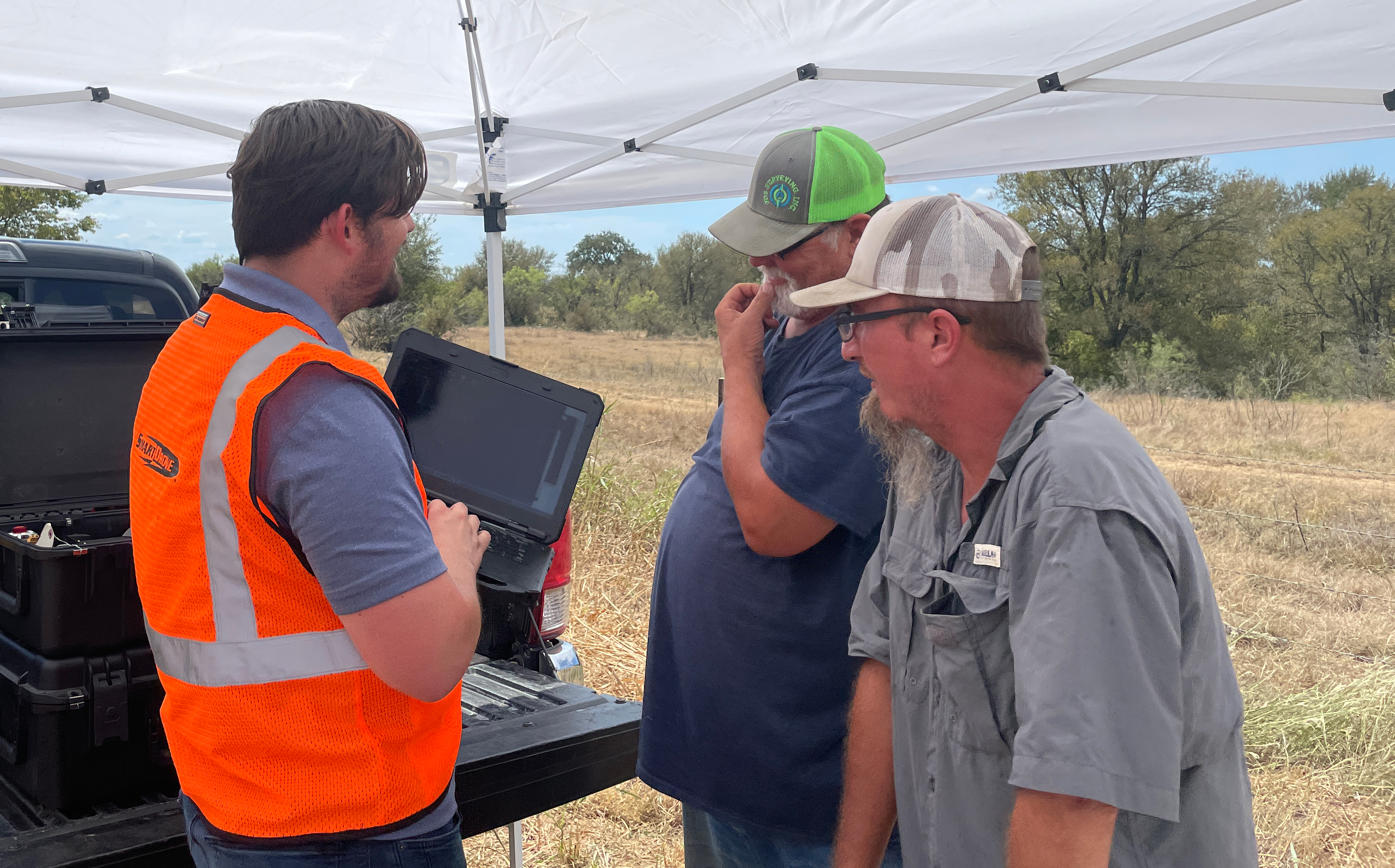
SmartDrone is a nationwide aerial mapping services provider and LiDAR drone manufacturer. Working directly with surveyors, civil engineers, and architects, SmartDrone deploys a local Field Application Specialist (FAS) to scan locations and deliver the requested deliverables. Some of these deliverables include a full point cloud, topos, orthos, vegetation filtered, linework, and more. By offering services and drone technology, which is used for services, SmartDrone works like an internal drone department for their clients.
How SmartDrone is Revolutionizing the Survey Industry
1. Cost-Effective
SmartDrone cuts surveying costs significantly by eliminating the need for multi-person crews and ground surveying methods. With the drone's ability to fly over vast areas, surveys that would usually take weeks can now be completed within a fraction of the time, with a single operator, and at a fraction of the cost.
2. On-Demand Services
In an industry that often faces time and logistics constraints, SmartDrone's on-demand service model is nothing short of groundbreaking. Thanks to their nationwide presence and fleet of Field Application Specialists, clients can request mapping services anytime, anywhere. This level of flexibility and convenience is unrivaled in the surveying industry, empowering businesses to make data-driven decisions swiftly and efficiently.
3. Improved Safety
Traditional surveying requires field workers to traverse dangerous terrain that poses significant risks to their safety. SmartDrone significantly reduces the need for fieldwork, meaning fewer hazards for ground crews and a safer work environment. This aspect of SmartDrone technology is particularly valuable for surveying environments such as construction and mining sites, where safety hazards are high.
4. Vertical Integration
SmartDrone is not only a service provider but also a manufacturer of their own specialized LiDAR drone, Discovery 2. By controlling the entire process, SmartDrone can ensure consistently high quality, reduce costs, and provide quicker, more seamless services. This level of integration makes SmartDrone a truly holistic solution, setting them apart from other service providers in the industry.
FAQs
Does SmartDrone replace traditional surveying methods or licensed surveyors?
No, SmartDrone does not entirely replace traditional surveying methods or licensed surveyors. Instead, it provides an innovative tool that complements and enhances these traditional methods. While SmartDrone's aerial mapping services significantly improve efficiency, safety, and cost-effectiveness, the interpretation and final application of this data often still require the expertise of licensed surveyors.
Additionally, there are certain contexts and environments where traditional surveying methods may still be more appropriate. In essence, SmartDrone represents an evolution of surveying technology that can work alongside traditional methods and licensed professionals, rather than a replacement.
Are aerial mapping methods as accurate as traditional surveying methods?
Yes, aerial mapping methods, particularly those involving LiDAR technology like the ones used by SmartDrone, can produce results that are just as accurate, if not more so, than traditional surveying methods.
LiDAR technology works by emitting rapid pulses of laser light at a surface, then measuring the amount of time it takes for each pulse to bounce back. By calculating these times, the system can create detailed, three-dimensional information about the shape and surface characteristics of the object or terrain.
This technology can often capture finer details than a human surveyor on the ground could, especially over large areas or rough terrains. However, it's worth noting that the ultimate accuracy of any survey, whether traditional or aerial, also depends on factors like the quality of the equipment used, the conditions during the survey, and the skill of the operators and analysts.
Conclusion
SmartDrone is indisputably revolutionizing the surveying industry with its pioneering approach. By adopting innovative technologies, prioritizing cost-effectiveness, offering on-demand services, and ensuring safety, SmartDrone has redefined the traditional mapping and surveying processes.
Furthermore, its vertical integration ensures that they provide seamless, high-quality services from start to finish. With these groundbreaking strategies, SmartDrone is paving the way for the future of the surveying industry.
The surveying and mapping industries are just beginning to feel the full impact of this revolution. With companies like SmartDrone leading the charge, it's an exciting time to watch the space and witness the incredible advancements still to come.