As technology continues to evolve, new advancements are revolutionizing various industries. In Atlanta, the tech scene is bustling with innovative ideas, one of which is the integration of drone technology into survey services. The forerunner in this revolution is SmartDrone, a company pushing the boundaries of drone applications.
The Innovation in Survey Services: SmartDrone
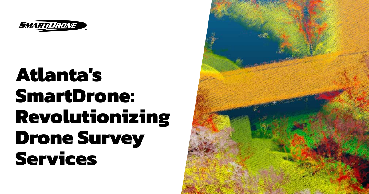
In the past, surveying involved strenuous efforts and a considerable amount of time. Now, aerial surveying has become increasingly popular, offering unique advantages. SmartDrone's new regional operations center provides drone-based survey services in Atlanta and surrounding areas throughout Georgia.
The Advantages of Using SmartDrone Professional Services
SmartDrone has a set of features that distinguish it from other providers. It has leveraged drone technology to perform accurate and efficient surveys with less time and personnel. This has resulted in a substantial reduction in costs and increased productivity for businesses opting for these services.
Accuracy
One of the primary advantages of SmartDrone professional services is its dedication to data accuracy and precision. With an intelligent and innovative system in place, it provides a precise representation of areas, resulting in accurate data for surveying and future planning.
On-Demand
Not all jobs call for our specialty mapping services and conventional methods work just fine. We are ready to perform our services only when you need us.
Safety
Drone surveys provide safer means to collect data from areas that are potentially hazardous or difficult to access. With SmartDrone, businesses can gather a greater amount of comprehensive information with fewer risks and resources.
Frequently Asked Questions
What kind of services does SmartDrone offer?
SmartDrone offers a variety of drone surveying services such as topographical surveys, orthomosaic generation, volumetric analysis, environmental monitoring, line work, and more.
Are there registered land surveyors on the SmartDrone team?
No, we do not. We are here to support and serve land surveyors with our drone data collection, processing, and delivering. Most of the work we do still requires validation from a registered land surveyor.
Is SmartDrone limited to Atlanta?
No, SmartDrone is based in Texas but provides services anywhere in the contiguous United States. Atlanta is one our sixteen regional operations centers.
Conclusion
Innovations like SmartDrone are reshaping the landscape of survey services. By combining the power of drone technology with professional expertise, SmartDrone has proven itself to be a game-changer in the industry. This revolution provides businesses with the tools necessary for more accurate and efficient surveying, helping them adapt to the demands of the future.
Looking for professional drone mapping services? Reach out to us for a comprehensive range of drone services, including high-quality orthomosaics and 3D mapping. We are here to elevate your projects to new heights.