It has never been easier to capture every precise detail of your property and share it with engineers, surveyors, and contractors with topographic drones. You can also use drones to provide accurate measurements of the land to plan for construction projects. With these drones, capturing topographies in different seasons or different vegetated terrains can be easy. Here are some reasons why you should invest in topographic drones for your business today.
Section 1: Drones and Surveying
Section 2: Drones and Construction
Section 3: Drones and Your Business
Section 4: Conclusion
Drones and Surveying
Not only can drones provide topographical data for a surveyor, but they can also help a surveyor check staking and monitor earthwork phases. Even if most of your work is more minor projects, your business may still benefit from lidar drones for gathering topo data, positively affecting productivity. Another area that drones could help with is improving the efficiency of extensive fieldwork. You can use drones to collect data from heavily vegetated and inhospitable terrains. Drones can be very helpful for surveying businesses concerned about safety, efficiency, and productivity.
Drones and Construction
There are so many reasons you should invest in a topographic drone that it can be challenging to know where to begin. The two most important things to consider when choosing a topographic drone are how much it will cost and how much time (and training) it will take to get the results you are looking for. There are many models, some with better options than others, some with better service than others. From inspecting the land to measuring dirt work for your first hut, these drones will give you the data you need to complete topographic jobs and work you can throw at them. Our advice? Be sure you've tested the workflow for yourself before buying - there's often more than just hardware in a buying decision.
Drones and Your Business
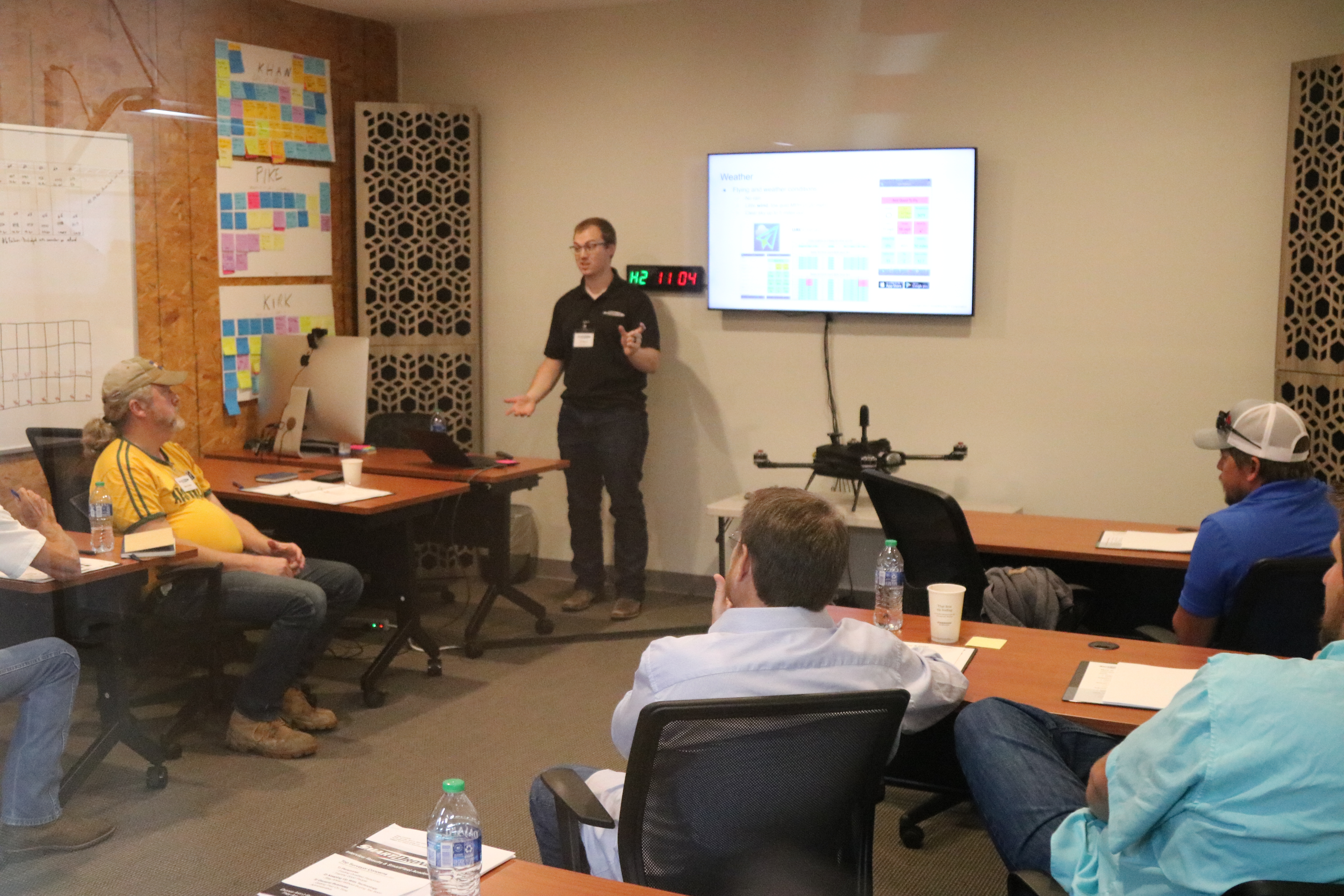
At SmartDrone, as our team put together their experience in the drone industry and aerial lidar topographic drones are the niche we decided to focus on. Not only were the surveyors we talked to encountering larger projects, but they were also having a ton of trouble finding crew chiefs and crew who wanted to work. Instead of growing their business, they had to turn work away. The quality of drone aerial lidar has been sufficient for decades, and it's been a matter of making it easy to use for a surveyor or businessperson - both in the office and in the field. These days, projects we scan often generate 100x or more detail than a standard topo would give. Having the drone capture these areas - then going back to their office and viewing the data and seeing how easy it can be to import this data in CAD - helps our clients see firsthand the productivity gains we are talking about.
Conclusion
By the end of this article, hopefully, you are one small step closer to how you can use drones to improve your surveying production, get higher precision results, and more. So, suppose you're interested in getting a drone. In that case, the first thing you should do is get some good training, research equipment with service and support that will stand behind you. Last tip - reach out to the manufacturers you're reading about and get a feel for their customer service because buying your industrial drone solution is the first step in a multi-year relationship with your solution provider of choice. You can reach out to us today and we’ll send over a PDF with some more information about Discovery.